Add-On Day Hikes from Kagbeni
Trip Details
- Destination: Nepal
- Trip Style: Trekking
- Accommodation: Hotel + Lodges
- Transportation: Jeep
- Grade: Moderate
- Meals: Breakfast, Lunch and Dinner
About Trip
The following day hikes can be done either as warm ups before the Upper Mustang trek; as add-ons at the end of the trek; or as part of a Lower Mustang trekking and/or touring package. With the exception of the Gyu-la Pass, the hikes do not require the Upper Mustang Restricted Area Permit, only the Annapurna Conservation Area Permit.
Three Villages Day Hike
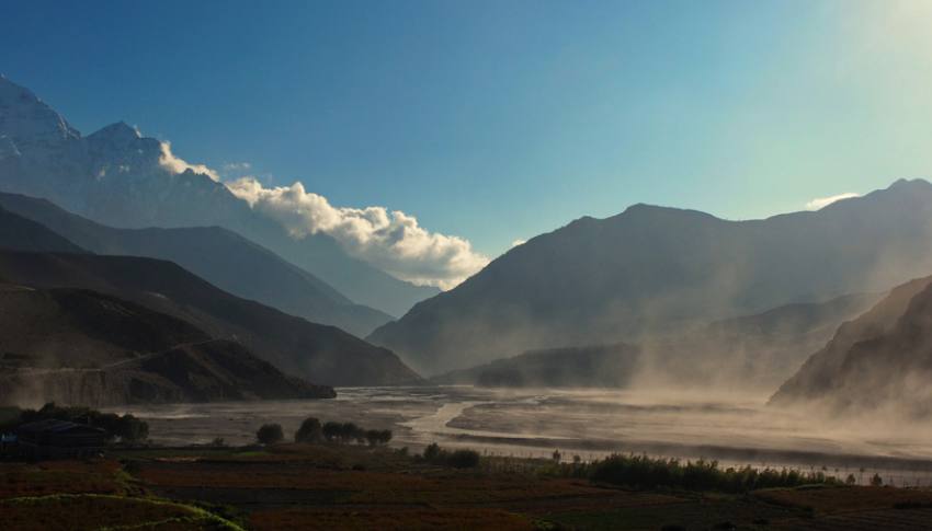
From Kagbeni we go either by jeep or on foot to Ekle Bhatti (2740m) and cross the Kaligandaki Khola by the suspension bridge. The first of the three villages on our route up is Pangling, still retaining much of its traditional charm and well worth spending a little time exploring. As we climb further up to Phalyak, the most modernized of the three villages, the views behind us over the valley of the Kaligandaki to the Nilgiri Massif and Muktinath Himal become ever more extensive. After a brunch break in Phalyak, we go to the last and most attractive of the villages, Dhakarjong, with its maze of narrow stone alleyways and old world charm. From Dhakarjong we can either extend the hike to the pass (3229m) which overlooks the Jomsom side of the hill (descent to Jomsom currently inadvisable due to the condition of the trail) or linger a while before retracing our steps down to Ekle Bhatti and back to Kagbeni.
Lubra Pass Day Hike
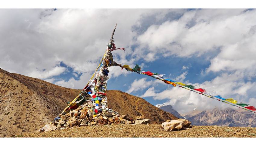
The Lubra Pass hike affords one of the grandest views in the area after a very modest climb. From Kagbeni we take a taxi to Ranipauwa (3700m) just before Muktinath and start our ascent to the Lubra Pass, marked by a lhato (shrine to the gods), which is about 4000m above sea level. Both the pass itself and the views it affords of the surrounding mountains, especially the Dhaulagiri Massif—at 8167m the seventh highest peak in the world and the highest within the borders of a single country—are stunning and unforgettable. From the pass we make a steep and long descent to Lubra Village (aka Ludak) deep in the Panda Khola gorge. Lubra consists of only about fourteen families who have preserved their traditional way of life in one of the very few totally Bon villages remaining in Nepal today. According to legends, the Bon lama, Yangton Tashi Gyaltsen, arrived here from Tibet and subdued the wrathful demons living here. To test whether or not a settlement here would flourish, he planted a walnut tree which still survives in Lubra to this day. The ancient Yungdung Phuntsok Ling Bon gompa is at the heart of the village in every way: the eldest son of every family must perform rituals and puja there on every auspicious day in the Bon calendar, thus ensuring the preservation of local traditions. Sadly flash floods occurring down the Panda Khola gorge in recent years have had a devastating impact on the houses nearest to the river side. After a well-deserved lunch and break in Lubra, we follow the river back down to the Jomsom / Kagbeni road at Panda, where transport is waiting to take us back to Kagbeni.
Tiri Short Hike
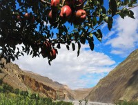
The short hike to Tiri (in full Tirigaon) from Kagbeni is peaceful and well worthwhile. For those pressed for time, it can easily be done as a half day walk, returning to Kagbeni for lunch, otherwise it can be experienced at a more leisurely pace. The walk starts by crossing the confluence (‘beni’) of two rivers near the dharmasala (pilgrims’ rest-house) where Hindu devotees from India as well as all over Nepal come to pray and perform ritual ablutions. The trail then meanders between stone walls and fields of wheat, barley and buckwheat before arriving at Tiri, a charming small village with stone alleyways leading between the houses and the possibility of a climb up to the old nunnery for those who wish. Tiri’s greatest attractions, perhaps, are its extensive apple orchards, making a visit here in September/October a ‘must’. Picking a fresh red or green Mustang apple from the tree and biting into its juicy crunchiness in such a setting makes for an unforgettable memory!
Syang, Dhumba Lake & Thinigaon Day Hike
In the morning we set off from Kagbeni by jeep/taxi to Syang village for the start of our day hike. Syang is divided into upper and lower parts on either side of the main road, the upper part boasting a mammoth new statue of Guru Rinpoche, the 8th century sage also known as Padmasambhava who was responsible for spreading Buddhism throughout the Himalayan swathe. From Lower Syang we cross the Kaligandaki River and walk through Dhumbal village, with its attractive apple orchards, before climbing up to Kutsap Teringa, the second oldest gomba in Mustang after Ghar Gomba, where the footprint of Guru Rinpoche is imprinted on a rock. The 360o views from the gomba, perched high on the edge of a ridge like a fortress, including the Dhaulagiri massif (8167m) are stunning. From here we walk down to the beautiful Dhumba Lake, or Turquoise Lake, sacred to both Buddhists and Hindus. The water—ice melt from Nilgiri—flows into the lake through an underground channel and the lake is frozen over in Winter. Fish in the lake are regarded as holy and are never caught or eaten. After being featured in the 2014 Nepali movie ‘Jerryy’, telling the love story of Xavier Rana and Akanchha, the place has also become popular with young Nepali visitors. After having lunch, we go to our final destination of the day, Thinigaon, another charming Mustang village on the hillside to the north of Jomsom, famous for its Snow Leopard Cave. From there we walk back down to Jomsom for our transportation back to Kagbeni.
Gyu-La Pass Day Hike
Note: This is the only trek in this section that requires the Upper Mustang Restricted Area Permit. As such, it is best done on the return from Lo Manthang after an overnight stop either in Chhuksang (recommended) or Kagbeni.
The trail from Chhuksang (2980m) starts to climb right away up to the hamlet of Tetang with its mani wall and Three Protectors (Rigsum Gonpo) chortens representing Manjushri (red), the bodhisattva of knowledge and wisdom; Chenrezig/Avalokiteshvara (white), the bodhisattva of immeasurable compassion; and Vajrapani (black/grey) the bodhisattva who combats evil. From there the trail leaves civilization far behind as it continues to climb up the rugged hillsides before finally emerging on the crest of the Gyu-la Pass (4077m), marked by a lhato or shrine to the gods. We have made a 1000m altitude gain from out starting point and from the pass the views over the Muktinath Himal and other
Trip Highlights
